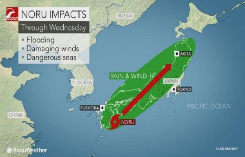
Deadly Severe Tropical Storm Noru will slowly cross southern and central Japan into Tuesday, unloading flooding rain and damaging winds.
Despite weakening from its peak strength, residents and visitors across Japan should be taking shelter ahead of Noru and should not take the storm lightly.
Noru slammed the northern Ryukyu Islands with excessive rainfall and will continue to unleash damaging winds and flooding rain along its path.
Two deaths and twelve injuries have already been attributed to the storm, according to a local media outlet.
After churning nearly stationary south of Kyushu at the start of the weekend, the typhoon slowly meandered northeastward through Sunday. The heaviest rain and strongest winds shifted from the northern Ryukyu Islands to eastern Kyushu.
Residents should brace for widespread downed trees, power outages and some minor structural damage. An inundating storm surge will further endanger lives and property in coastal areas.
Noru will crawl across Shikoku to western Honshu from Sunday night into Monday. On Tuesday, Noru is expected to be along central Honshu's coast with the Sea of Japan.
Interaction with the mountainous terrain will cause Noru to weaken as it crosses Japan. While that will lessen the risk of damaging winds, flooding rain will continue to be unloaded.
Heavy rain on the magnitude of 150 to 300 mm (6 to 12 inches) will pour down across eastern Kyushu, Shikoku and west-central Honshu. Locally higher amounts are likely, especially in the mountains. Life-threatening flooding and mudslides are a serious concern.
Naze, located on Amami Ōshima Island, has been inundated with 680.5 mm (26.8 inches) of rain from Friday to Sunday, local time. The island was also battered by wind gusts of 92 km/h (57 mph).
"With a system coming across China and steering Noru northward, South Korea will likely be spared of Noru's dangerous impacts," AccuWeather Meteorologist Jordan Root said.
South Korea could have some showers into early week associated with an uptick in moisture from Noru's close approach, but in general, the heaviest rain will stay well to the east.
Around midweek, Noru is likely to spread its heavy rain and gusty winds over northern Japan.
"Noru will be in a weakened state at this point, but heavy rain and rough surf along the west coast of Japan can still occur," Root cautioned.
Noru has been on a long journey across the West Pacific. Noru formed on July 20, then reached super typhoon status and became the strongest tropical cyclone on the planet so far this year on July 30.